(1 of 2) ...The Flood Warning is extended for the following rivers in North Carolina...South Carolina... Cape Fear River At William O Huske Lock And Dam 3 affecting Cumberland and Bladen Counties. Great Pee Dee River At Pee Dee affecting Florence and Marion Counties. * WHAT...Minor flooding is forecast. * WHERE...Cape Fear River at William O Huske Lock And Dam 3. * WHEN...Until early Saturday morning. * IMPACTS...At 42.0 feet, Water levels will top the navigational lock and equipment must be removed. Minor flooding will occur on land adjacent to the east bank of the river. * ADDITIONAL DETAILS... - At 9:00 PM EDT Wednesday the stage was 41.9 feet. - Forecast...The river is expected to rise above flood stage late this evening to a crest of 42.4 feet early tomorrow afternoon. It will then fall below flood stage late Friday morning. - Flood stage is 42.0 feet. - weather.gov/safety/flood (2 of 2) ...The National Weather Service in Newport/Morehead City NC has issued a Flood Warning for the following rivers in North Carolina... Trent River At Trenton affecting Jones County. For the Non-forecast Points (warnings)...including Swift Creek at Vanceboro, Pollocksville, Bogue Sound at HWY 58 at Emerald Isle, Farmville, Rock Springs, Grimesland, Grifton, Gum Branch, Washington, Parker Creek Above Greenville, Simpson, Spring Garden, Little Contentnea Creek Near Ayden, Beulaville, Oak City, Streets Ferry, Green Mill Run in Greenville, Hamilton, New River at Jacksonville, Johnsons Mill Run Near Greenville, Trenton...Minor flooding is forecast. * WHAT...Minor flooding is occurring and minor flooding is forecast. * WHERE...Trent River at Trenton. * WHEN...From this afternoon until further notice. * IMPACTS...At 14.0 feet, Boat Launch area at the end of Landfill Road is flooded, and parts of Landfill Road may be flooded. The end of West Jones Street is inundated as well. * ADDITIONAL DETAILS... - At 12:20 PM EDT Wednesday the stage was 14.1 feet. - Recent Activity...The maximum river stage in the 24 hours ending at 12:20 PM EDT Wednesday was 14.1 feet. - Forecast...The river will continue to rise slowly for the rest of today, and likely crest sometime tonight. - Flood stage is 14.0 feet. - http://www.weather.gov/safety/flood
RepeaterBook.com Home Page
honey pot Buxton, North Carolina, 462.725, WRZY287 Repeater

Buxton, NC

WRZY287

GMRS Repeater ID: 37-1099
Downlink: 462.725
Uplink: 467.725
Uplink Tone: LOG IN TO VIEW
Downlink Tone: LOG IN TO VIEW
County: Dare
GPS*: 35.2629 -75.5288
Owner: WRZY287
Use: OPEN
Op Status: ON-AIR On-Air
Coverage: 
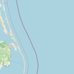
Buxton, Frisco, south Avon for HT, Hatteras village to almost Salvo for mobile
20 mi radius.
Sponsor: WRZY287
Notes: Please follow FCC Rules and use with good radio practices. If your GMRS equipment has a Roger Beep or Courtesy Tone option, please disable for repeater use.
Marker
30 km
30 mi
Leaflet © OSM contributors

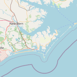
Exact coordinates of the repeater are known.
Coverage circle based on mobile coverage and ignores propagation anomalies and terrain.

Signal Reports (click map icon for details): Base Mobile HT
Add a Signal Report