(1 of 9) ...The Flood Warning is extended for the following rivers in Oklahoma... Poteau River near Poteau affecting Le Flore County. ...The Flood Warning continues for the following rivers in Oklahoma... Poteau River near Panama affecting Le Flore County. * WHAT...Moderate flooding is occurring and moderate flooding is forecast. * WHERE...Poteau River near Poteau. * WHEN...Until tomorrow afternoon. * IMPACTS...At 26.0 feet, moderate valley flooding affects croplands and farm roads from southeast of Poteau to the mouth of Brazil Creek. * ADDITIONAL DETAILS... - At 7:45 PM CDT Saturday the stage was 26.5 feet. - Forecast...The river is expected to rise to a crest of 27.0 feet just after midnight tonight. It will then fall below flood stage late tomorrow morning. - Flood stage is 24.0 feet. - http://www.weather.gov/safety/flood (2 of 9) ...The Flood Warning is extended for the following rivers in Oklahoma... Poteau River near Poteau affecting Le Flore County. ...The Flood Warning continues for the following rivers in Oklahoma... Poteau River near Panama affecting Le Flore County. * WHAT...Moderate flooding is occurring and moderate flooding is forecast. * WHERE...Poteau River near Panama. * WHEN...Until late Monday evening. * IMPACTS...At 41.0 feet, very severe flooding occurs from near Poteau to Arkoma. Up to 20,000 acres of farmland is flooded. Several county roads crossing the Poteau River are totally impassable. This is a dangerous and life threatening situation. * ADDITIONAL DETAILS... - At 8:30 PM CDT Saturday the stage was 38.1 feet. - Forecast...The river is expected to rise to a crest of 40.3 feet early tomorrow afternoon. It will then fall below flood stage Monday afternoon. - Flood stage is 29.0 feet. - http://www.weather.gov/safety/flood (3 of 9) ...The Flood Warning is extended for the following rivers in Oklahoma... Kiamichi River near Antlers affecting Pushmataha County. * WHAT...Minor flooding is forecast. * WHERE...Kiamichi River near Antlers. * WHEN...From this evening to tomorrow evening. * IMPACTS...At 25.0 feet, minor flooding begins along the west bank of the Kiamichi River near Moyers. Campers along the river should move to higher ground. * ADDITIONAL DETAILS... - At 7:30 PM CDT Saturday the stage was 24.1 feet. - Forecast...The river is expected to rise above flood stage late this evening to a crest of 25.8 feet tomorrow morning. It will then fall below flood stage early tomorrow afternoon. - Flood stage is 25.0 feet. - http://www.weather.gov/safety/flood (4 of 9) ...The Flood Warning is extended for the following rivers in Oklahoma... Clear Boggy Creek near Caney affecting Atoka County. * WHAT...Minor flooding is occurring and minor flooding is forecast. * WHERE...Clear Boggy Creek near Caney. * WHEN...Until early tomorrow afternoon. * IMPACTS...At 26.0 feet, The creek reaches bankfull levels in western Atoka County and the northeastern edge of Bryan County. High stages on small feeder streams could further result in greater-than-bankfull overflows to mainstem bottomlands. Croplands... pastures... and some secondary rural roads along and near Clear Boggy Creek are affected. * ADDITIONAL DETAILS... - At 7:30 PM CDT Saturday the stage was 26.5 feet. - Bankfull stage is 26.0 feet. - Forecast...The Clear Boggy Creek is expected to fall below flood stage tomorrow morning and continue falling. - Flood stage is 26.0 feet. - http://www.weather.gov/safety/flood (5 of 9) ...The Flood Warning is extended for the following rivers in Oklahoma... Illinois River near Tahlequah affecting Cherokee County. Illinois River at Chewey affecting Adair, Cherokee and Delaware Counties. Illinois River near Watts affecting Adair and Delaware Counties. * WHAT...Minor flooding is occurring and moderate flooding is forecast. * WHERE...Illinois River near Watts. * WHEN...Until early Monday morning. * IMPACTS...At 17.0 feet, moderate flooding occurs from the Arkansas border to Fidler's Bend. Farmlands and permanent campgrounds are affected. A few cabins in the Fidler's Bend area may have minor flooding. Extreme turbulence makes the river too hazardous for floating. * ADDITIONAL DETAILS... - At 7:30 PM CDT Saturday the stage was 15.5 feet. - Forecast...The river is falling but is expected to rise again later tonight, cresting near 17.8 feet tomorrow morning. It will then fall below flood stage tomorrow evening. - Flood stage is 13.0 feet. - http://www.weather.gov/safety/flood (6 of 9) ...The Flood Warning is extended for the following rivers in Oklahoma... Illinois River near Tahlequah affecting Cherokee County. Illinois River at Chewey affecting Adair, Cherokee and Delaware Counties. Illinois River near Watts affecting Adair and Delaware Counties. * WHAT...Minor flooding is occurring and moderate flooding is forecast. * WHERE...Illinois River at Chewey. * WHEN...Until Monday morning. * IMPACTS...At 15.0 feet, moderate flooding occurs from near Fidler's Bend to near Hanging Rock. Moderate flooding of agricultural lands may result in livestock issues. Travel around Hanging Rock is impacted. Road access near the river is cut off to residential homes southeast of Chewey Bridge. Access to Winset Hollow is cut off. A few cabins in the Fidler's Bend area may have minor flooding. Extreme turbulence makes the river too hazardous for floating. * ADDITIONAL DETAILS... - At 7:15 PM CDT Saturday the stage was 14.4 feet. - Forecast...The river is expected to rise to near 15 feet just after midnight tonight and fluctuate between 14 and 15 feet before eventually rising to a crest of 15.2 feet just after noon Sunday. The river will then begin falling, and fall below flood stage early Monday morning. - Flood stage is 12.0 feet. - http://www.weather.gov/safety/flood (7 of 9) ...The Flood Warning is extended for the following rivers in Oklahoma... Illinois River near Tahlequah affecting Cherokee County. Illinois River at Chewey affecting Adair, Cherokee and Delaware Counties. Illinois River near Watts affecting Adair and Delaware Counties. * WHAT...Minor flooding is occurring and moderate flooding is forecast. * WHERE...Illinois River near Tahlequah. * WHEN...Until late Monday evening. * IMPACTS...At 15.0 feet, moderate flooding occurs from Hanging Rock downstream towards Tahlequah. Access roads east of the Combs Bridge near Eagles Bluff are impassable. Some cabins and parks may begin to flood. Extreme turbulence makes the river too hazardous for floating. * ADDITIONAL DETAILS... - At 7:30 PM CDT Saturday the stage was 12.3 feet. - Forecast...The river is expected to rise to a crest of 15.9 feet tomorrow evening. It will then fall below flood stage Monday afternoon. - Flood stage is 11.0 feet. - http://www.weather.gov/safety/flood (8 of 9) ...The National Weather Service in Tulsa OK has issued a Flood Warning for the following rivers in Oklahoma... Baron Fork River at Eldon affecting Cherokee County. * WHAT...Minor flooding is occurring and minor flooding is forecast. * WHERE...Baron Fork River at Eldon. * WHEN...From this evening to tomorrow morning. * IMPACTS...At 18.0 feet, minor lowland flooding occurs. * ADDITIONAL DETAILS... - At 7:30 PM CDT Saturday the stage was 18.1 feet. - Forecast...The river is near crest and is expected to fall below flood stage just after midnight tonight. Thereafter, the river will continue falling and remain below flood stage. - Flood stage is 18.0 feet. - http://www.weather.gov/safety/flood (9 of 9) ...The Flood Warning continues for the following rivers in Oklahoma... Glover River At Glover affecting McCurtain County. For the Glover River...including Glover...Minor flooding is forecast. * WHAT...Minor flooding is forecast. * WHERE...Glover River at Glover. * WHEN...Until Sunday afternoon. * IMPACTS...At 16.0 feet, The Glover River is at flood stage with minor flooding at its confluence with the Little River west of Golden, Oklahoma. * ADDITIONAL DETAILS... - At 1:30 PM CDT Saturday the stage was 12.2 feet. - Bankfull stage is 16.0 feet. - Forecast...The river is expected to rise to a crest of 16.0 feet this evening. - Flood stage is 16.0 feet. - Flood History...This crest compares to a previous crest of 15.9 feet on 12/15/1992. - http://www.weather.gov/safety/flood
RepeaterBook.com Home Page
honey pot Stillwater, Oklahoma, 444.475, K5FVL Repeater

Stillwater, OK

K5FVL
Repeater ID: 40-8062

Downlink: 444.47500
Uplink: 449.47500
Offset: +5.000 MHz
Uplink Tone: 100.0
DMR Enabled
Color Code: 1
DMR ID: DMR ID Needed
County: Payne
Call: K5FVL
Use: OPEN
Op Status: ON-AIR On-Air
Coverage:
Sponsor: K5FVL/ <a href="http://w5ias.com" rel="nofollow">Tulsa Amateur Radio Club (TARC)</a>
Features: Linked, WX.
FM: Yes; analog capable.
Analog Bandwidth: 25.0 kHz (wideband)
Coordination: ORSI
Last updated: 2024-06-27
Last reviewed: 2024-06-27
30 km
30 mi
Leaflet | © OpenStreetMap, © OpenStreetMap contributors

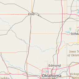
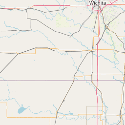
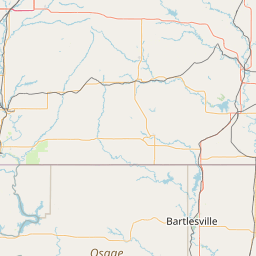
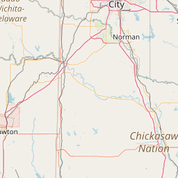
Exact coordinates of the repeater are not known. Location is approximate.

Add a Propagation Report

- Base - HT - Mobile
Click the icons on map for details.


Date Information Updated
2021-01-29 16:28:31 Added.

Call Date Information
KC5FM (registered) 2022-05-23 Reported on-air.


Visit our DMR pages | Learn more about DMR | NetWatch

- DMR Talk groups are updated directly on radioid.net or BrandMeister.network.
- The IPSC Network is obtained from the radioid.net API. If this information is not correct, please update it at radioid.net.
- Did you know that Repeaterbook has its own BrandMeister talk group? Find us at 31419 (BrandMeister only).

   
If you have an iPhone/iPod/iPad or Android device, please download the FREE official RepeaterBook app!


Copyright © 2006-2025 RepeaterBook.com. All Rights Reserved.
Created and owned by KD6KPC/WREQ745 since 2006.
All data, including non-copyrightable data, is protected from theft under Oregon law (ORS 164.377).

Page created in 0.045400 seconds.