| Downlink: | 146.91000 |
| Uplink: | 146.31000 |
| Offset: | -0.600 MHz |
| Uplink Tone: | 131.8 |
| Downlink Tone: | 131.8 |
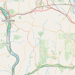
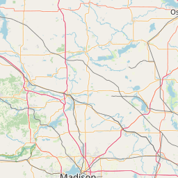
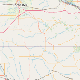
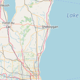
| County: | Richland |
| Grid: | EN46aa |
| Call: | W9PVR |
| Use: | OPEN |
| Op Status: | |
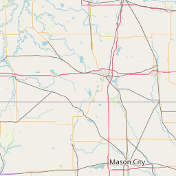
| Coverage: |
Wide area. HWY 14, HWY 60 & HWY 80 Wide area coverage. 50 mi mi radius. |
| Sponsor: | PVRARC (Pine Valley Repeater Amateur Radio Club) |
| Affiliate: | ARRL |
| Features: |
Weather nets / Discussions Emergency power equipped. |
| FM: | Yes; analog capable. |
| Analog Bandwidth: | 25.0 kHz (wideband) |
| Notes: | Covers HWY 14 from Coon Valley to Black Earth well |
| Nets: | PVR ARC Richland County ARES/RACES Net Sunday night |
| Coordination: | WAR |
| Last updated: 2023-02-13 | |
| Last reviewed: 2024-09-11 | |


Exact coordinates of the repeater are known.
Coverage circle does not account for propagation anomalies or terrain.
| Click the icons on map for details. | ||

A friendly repeater with great southwest Wisconsin coverage A nice Sunday night net at 9 pm summer and 7 pm winter. skywarn weather nets are here as well as ARES/RACES activities. but just general rag-chewing is also great as well. WWW.W9WPVR..org
Activity
Travel
Posted by: KC9CMD