(1 of 2) ...The Flood Warning continues for the following rivers in North Carolina... Trent River At Trenton affecting Jones County. * WHAT...Minor flooding is occurring. * WHERE...Trent River at Trenton. * WHEN...Until further notice. * IMPACTS...At 14.0 feet, Boat Launch area at the end of Landfill Road is flooded, and parts of Landfill Road may be flooded. The end of West Jones Street is inundated as well. * ADDITIONAL DETAILS... - At 11:20 AM EDT Thursday the stage was 15.3 feet. - Recent Activity...The maximum river stage in the 24 hours ending at 11:20 AM EDT Thursday was 15.3 feet. - Forecast...No forecast is available for this location. - Flood stage is 14.0 feet. - http://www.weather.gov/safety/flood (2 of 2) ...The Flood Warning is extended for the following rivers in North Carolina... Cape Fear River At William O Huske Lock And Dam 3 affecting Cumberland and Bladen Counties. ...The Flood Warning continues for the following rivers in South Carolina... Great Pee Dee River At Pee Dee affecting Marion and Florence Counties. * WHAT...Minor flooding is occurring and minor flooding is forecast. * WHERE...Cape Fear River at William O Huske Lock And Dam 3. * WHEN...Until Saturday evening. * IMPACTS...At 42.0 feet, Water levels will top the navigational lock and equipment must be removed. Minor flooding will occur on land adjacent to the east bank of the river. * ADDITIONAL DETAILS... - At 10:00 AM EDT Thursday the stage was 42.7 feet. - Forecast...The river is expected to rise to a crest of 43.1 feet just after midnight tonight. It will then fall below flood stage early Saturday morning. - Flood stage is 42.0 feet. - weather.gov/safety/flood
honey pot Kinston, North Carolina, 442, N4HAJ Repeater

Kinston, NC

N4HAJ
Repeater ID: 37-402

Downlink: 442.00000
Uplink: 447.00000
Offset: +5.000 MHz
Uplink Tone: 88.5
County: Lenoir
Call: N4HAJ
Use: OPEN
Op Status: ON-AIR On-Air
Coverage:
Sponsor: N4HAJ
Features: Closed autopatch, WX.
Emergency power equipped.
FM: Yes; analog capable: 25.0 kHz (wideband)
Links:
System Links:
Full-time to the Down East Link System.
Last updated: 2025-04-30
Last reviewed: 2025-04-30
Marker
30 km
30 mi
Leaflet © OSM contributors

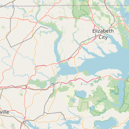
Exact coordinates of the repeater are not known.
Coverage circle based on mobile coverage and ignores propagation anomalies and terrain.

Signal Reports (click map icon for details): Base Mobile HT
Add a Signal Report


Call Date Details
KQ4EAS (registered) 2025-04-05 Added to Down East Linked System.
KE4TZN (registered) 2024-02-11 Reported on-air.