(1 of 5) ...The Flood Warning continues for the following rivers in Alabama... Tombigbee River Near Leroy affecting Clarke and Washington Counties. For the Tombigbee River...including Coffeeville Dam - upstream, Coffeeville Dam, Leroy...Minor flooding is forecast. * WHAT...Minor flooding is occurring. * WHERE...Tombigbee River near Leroy. * WHEN...Until further notice. * ADDITIONAL DETAILS... - At 8:00 PM CDT Wednesday the stage was 25.3 feet. - Forecast...The river is expected to rise to a crest of 26.5 feet Saturday morning. - Flood stage is 24.0 feet. - http://www.weather.gov/safety/flood (2 of 5) ...The Flood Warning continues for the following rivers in Alabama... Tombigbee River At Demopolis Lock and Dam affecting Greene, Sumter, Marengo and Hale Counties. .Rises continue on the Tombigbee River approaching flood stage, and a flood warning remains in effect at Demopolis Lock and Dam. * WHAT...Minor flooding is forecast. * WHERE...Tombigbee River at Demopolis Lock and Dam. * WHEN...From late tonight to tomorrow evening. * ADDITIONAL DETAILS... - At 8:15 PM CDT Wednesday the stage was 67.3 feet. - Forecast...The river is expected to rise to a crest of 68.0 feet just after midnight tonight. It will then fall below flood stage tomorrow morning. - Flood stage is 68.0 feet. (3 of 5) ...The Flood Warning continues for the following rivers in Alabama... Black Warrior River At Selden Lock and Dam affecting Greene, Marengo and Hale Counties. .Flooding continues on the Black Warrior River and a flood warning remains in effect at Selden Lock and Dam. * WHAT...Minor flooding is occurring and minor flooding is forecast. * WHERE...Black Warrior River at Selden Lock and Dam. * WHEN...Until early Friday morning. * ADDITIONAL DETAILS... - At 8:15 PM CDT Wednesday the stage was 92.0 feet. - Recent Activity...The maximum river stage in the 24 hours ending at 8:15 PM CDT Wednesday was 92.1 feet. - Forecast...The river is expected to fall below flood stage early tomorrow afternoon and continue falling to 79.3 feet Monday evening. - Flood stage is 90.0 feet. (4 of 5) ...The Flood Warning continues for the following river in Alabama... Alabama River Near Claiborne Dam affecting Wilcox, Monroe and Clarke Counties. For the Alabama River...including Millers Ferry Dam, Claiborne Dam... Minor flooding is forecast. Additional information is available at www.weather.gov/mob. Click on the Rivers and Lakes menu for forecasts and observations. The next statement will be issued when updates occur. * WHAT...Minor flooding is forecast. * WHERE...Alabama River near Claiborne Dam. * WHEN...From Thursday morning to early Saturday morning. * IMPACTS...At 42.0 feet, water begins to inundate the Eureka Landing community. At 43.0 feet, access to Eureka Landing community stops, with access cut off. * ADDITIONAL DETAILS... - At 8:45 AM CDT Wednesday the stage was 40.0 feet. - Forecast...The river is expected to rise above flood stage tomorrow morning to a crest of 42.7 feet early Friday morning. It will then fall below flood stage Friday evening. - Flood stage is 42.0 feet. - http://www.weather.gov/safety/flood (5 of 5) ...The Flood Warning continues for the following river in Alabama... Tombigbee River Near Coffeeville Dam affecting Choctaw, Washington and Clarke Counties. For the Tombigbee River...including Coffeeville Dam - upstream, Coffeeville Dam, Leroy...Minor flooding is forecast. Additional information is available at www.weather.gov/mob. Click on the Rivers and Lakes menu for forecasts and observations. The next statement will be issued when updates occur. * WHAT...Minor flooding is occurring and minor flooding is forecast. * WHERE...Tombigbee River near Coffeeville Dam. * WHEN...Until further notice. * IMPACTS...At 29.0 feet, pastureland becomes flooded. Livestock should be moved to higher ground. Old Ferry Road near the river begins to flood. At 40.0 feet, widespread flooding of timber and pastureland. Portions of State Highway 114 east of the river becomes covered by water. Cabins on Old Ferry Road flood. * ADDITIONAL DETAILS... - At 9:30 AM CDT Wednesday the stage was 31.4 feet. - Recent Activity...The maximum river stage in the 24 hours ending at 9:30 AM CDT Wednesday was 31.4 feet. - Forecast...The river is expected to rise to a crest of 32.8 feet early Friday morning. - Flood stage is 29.0 feet. - http://www.weather.gov/safety/flood
honey pot Magnolia Springs, Alabama, 1285, KI4SAZ Repeater

Magnolia Springs, AL

KI4SAZ
Repeater ID: 01-3806

Downlink: 1285.00000
Uplink: 1265.00000
Offset: -20.000 MHz
D-STAR Enabled
Node: KI4SAZ (A)
County: Baldwin
Call: KI4SAZ
Use: OPEN
Op Status: ON-AIR On-Air
Coverage:
Affiliate: Alabama Linked Repeater System
Web links: Affiliate: Alabama Linked Repeater System.
jfindu
dstarusers.org
APRS.fi
Last updated: 2025-05-09
Last reviewed: 2025-05-09
Marker
50 km
30 mi
Leaflet © OSM contributors

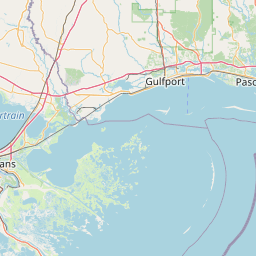
Exact coordinates of the repeater are not known.
Coverage circle based on mobile coverage and ignores propagation anomalies and terrain.

Signal Reports (click map icon for details): Base Mobile HT
Add a Signal Report


Date Information Updated
2021-01-29 16:28:31 Added.
2021-01-29 16:26:42 I-10 coverage added.
2021-01-29 16:26:42 I-65 coverage added.

Call Date Details
K4EES (registered) 2024-04-26 Reported on-air.
K4EES (registered) 2024-04-26 K4EES has requested the following, I have visited the Mag Springs site with system admins and all 3 of the modules are on line.