Brody School of Medicine - KE4TZN
Greenville, NC
Repeater ID: 37-373

| Downlink: | 444.72500 |
| Uplink: | 449.72500 |
| Offset: | +5.000 MHz |
| Uplink Tone: | 91.5 |
| Downlink Tone: | 91.5 |
| County: | Pitt |
| Grid: | FM15ho |
| Call: | KE4TZN |
| Use: | OPEN |
| Op Status: | |
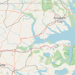
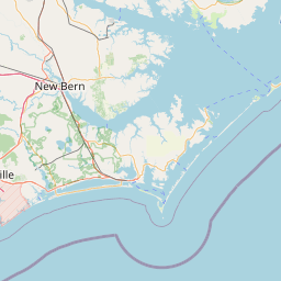
| Coverage: |
18 mi radius. |
| Sponsor: | Pitt County Repeater Association |
| Features: | Emergency power equipped. |
| FM: | Yes; analog capable: 25.0 kHz (wideband) |
| Links: | |
| Last updated: 2025-04-30 | |
| Last reviewed: 2025-04-30 | |


Exact coordinates of the repeater are
known.
Coverage circle based on mobile coverage and ignores propagation anomalies and terrain.