(1 of 6) ...The Flood Warning continues for the following rivers in Michigan... River Raisin At Blissfield affecting Lenawee and Monroe Counties. For the River Raisin...including Tecumseh, Adrian, Blissfield, Dundee, Monroe City...Minor flooding is forecast. * WHAT...Minor flooding is forecast. * WHERE...River Raisin at Blissfield. * WHEN...Until Sunday afternoon. * ADDITIONAL DETAILS... - The 10 PM estimated stage was 682.9 feet. - Forecast...The river is expected to rise to a crest of 683.6 feet early Saturday afternoon. It will then fall below flood stage late Sunday morning. - Flood stage is 683.0 feet. - http://www.weather.gov/safety/flood (2 of 6) ...The Flood Warning continues for the following rivers in Michigan... Manistee River near Sherman affecting Wexford County. For the Manistee River...including Sherman...Minor flooding is forecast. * WHAT...Minor flooding is occurring and minor flooding is forecast. This approaches the flood of record. * WHERE...Manistee River near Sherman. * WHEN...Until Tuesday morning. * IMPACTS...At 15.0 feet, Flooding begins around the Wilderness Canoe livery along left bank of river just downstream of M-37 bridge. * ADDITIONAL DETAILS... - At 8:45 PM EDT Friday the stage was 15.2 feet. - Bankfull stage is 14.0 feet. - Recent Activity...The maximum river stage in the 24 hours ending at 8:45 PM EDT Friday was 15.8 feet. - Forecast...The river is expected to fall below flood stage early Tuesday morning and continue falling to 14.4 feet Friday, April 11. - Flood stage is 15.0 feet. - Flood History...This crest compares to a previous crest of 15.1 feet on 06/17/2015. - http://www.weather.gov/safety/flood (3 of 6) ...The Flood Warning continues for the following rivers in Michigan... Cass River At Frankenmuth affecting Saginaw County. For the Cass River...including Cass City, Vassar, Frankenmuth... Minor flooding is forecast. * WHAT...Minor flooding is occurring and minor flooding is forecast. * WHERE...Cass River at Frankenmuth. * WHEN...Until late Sunday morning. * ADDITIONAL DETAILS... - At 7:45 PM EDT Friday the stage was 19.9 feet. - Forecast...The river is expected to fall below flood stage early Sunday morning. - Flood stage is 17.0 feet. - http://www.weather.gov/safety/flood (4 of 6) ...The Flood Warning continues for the following rivers in Michigan... Sycamore Creek At Holt affecting Ingham County. Red Cedar River At East Lansing affecting Ingham County. Portage River near Vicksburg affecting Kalamazoo County. .Additional rainfall from one quarter to one half inch is expected tonight. This isn't expected to worsen the flooding but will slow the fall on the rivers. * WHAT...Minor flooding is occurring and minor flooding is forecast. * WHERE...Portage River near Vicksburg. * WHEN...Until early Sunday morning. * IMPACTS...At 5.0 feet, Expect overflows into wooded areas, yards, a few outbuildings, and farmland adjacent to the river. * ADDITIONAL DETAILS... - At 3:30 PM EDT Thursday the stage was 5.0 feet. - Bankfull stage is 4.5 feet. - Recent Activity...The maximum river stage in the 24 hours ending at 3:30 PM EDT Thursday was 5.0 feet. - Forecast...The river is expected to rise to a crest of 5.2 feet this afternoon. It will then fall below flood stage just after midnight tonight. - Flood stage is 5.0 feet. - Flood History...This crest compares to a previous crest of 5.2 feet on 05/20/2019. - http://www.weather.gov/safety/flood (5 of 6) ...The Flood Warning continues for the following rivers in Michigan... Sycamore Creek At Holt affecting Ingham County. Red Cedar River At East Lansing affecting Ingham County. Portage River near Vicksburg affecting Kalamazoo County. .Additional rainfall from one quarter to one half inch is expected tonight. This isn't expected to worsen the flooding but will slow the fall on the rivers. * WHAT...Minor flooding is occurring and minor flooding is forecast. * WHERE...Sycamore Creek at Holt. * WHEN...Until early Sunday afternoon. * IMPACTS...At 8.0 feet, Expect minor flooding of low lying areas adjacent to the river, in the Lansing Municipal Golf Course and sections of East Mt. Hope Road. * ADDITIONAL DETAILS... - At 11:00 AM EDT Friday the stage was 8.4 feet. - Bankfull stage is 6.0 feet. - Recent Activity...The maximum river stage in the 24 hours ending at 11:00 AM EDT Friday was 8.8 feet. - Forecast...The river is expected to fall below flood stage early tomorrow afternoon and continue falling to 4.5 feet Friday, April 11. - Flood stage is 8.0 feet. - Flood History...This crest compares to a previous crest of 8.4 feet on 04/20/2013. - http://www.weather.gov/safety/flood (6 of 6) ...The Flood Warning continues for the following rivers in Michigan... Sycamore Creek At Holt affecting Ingham County. Red Cedar River At East Lansing affecting Ingham County. Portage River near Vicksburg affecting Kalamazoo County. .Additional rainfall from one quarter to one half inch is expected tonight. This isn't expected to worsen the flooding but will slow the fall on the rivers. * WHAT...Minor flooding is occurring and minor flooding is forecast. * WHERE...Red Cedar River at East Lansing. * WHEN...Until Monday evening. * IMPACTS...At 8.0 feet, The Potter Park Zoo parking lot in Lansing begins to flood. * ADDITIONAL DETAILS... - At 11:30 AM EDT Friday the stage was 7.5 feet. - Bankfull stage is 6.0 feet. - Recent Activity...The maximum river stage in the 24 hours ending at 11:30 AM EDT Friday was 7.5 feet. - Forecast...The river is expected to rise to a crest of 7.8 feet just after midnight tonight. It will then fall below flood stage Monday morning. - Flood stage is 7.0 feet. - Flood History...This crest compares to a previous crest of 7.9 feet on 04/21/2013. - http://www.weather.gov/safety/flood
RepeaterBook.com Home Page
honey pot Dundee, Michigan, 442.825, K8RPT Repeater

Dundee, MI

K8RPT
Repeater ID: 26-288

Downlink: 442.82500
Uplink: 447.82500
Offset: +5.000 MHz
Uplink Tone: 100.0
Downlink Tone: 100.0
DMR Enabled
Color Code: 1
DMR ID: 313549
IPSC Network: BM - Color Code: 1 - TS Linked: Mixed Mode - Trustee: radio id dot net antenna logo WA8EFK
Time Slot # 1 - 3126 = Michigan
Time Slot # 1 - 31266 = ?
Time Slot # 2 - 313549 = LOCAL

Information courtesy of radioid.net and the BrandMeister Network. Repeater trustees can directly update this data through their respective websites.
IPSC: BrandMeister US
County: Monroe
Grid: EN81ew
Call: K8RPT
Use: OPEN
Op Status: ON-AIR On-Air
Coverage: 20 mi radius.
Sponsor: <a href="https://freeshell.de/~bcspro/rrra/index.php">River Raisin Repeater Association</a>
Features: Emergency power equipped.
FM: Yes; analog capable.
Analog Bandwidth: 25.0 kHz (wideband)
Web links: River Raisin Repeater Association
Coordination: MiARC
Last updated: 2019-11-06
Last reviewed: 2023-09-03
30 km
20 mi
Leaflet | © OpenStreetMap, © OpenStreetMap contributors

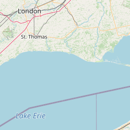
Exact coordinates of the repeater are not known. Location is approximate.

Add a Propagation Report

- Base - HT - Mobile
Click the icons on map for details.


Date Information Updated
2024-01-18 00:43:05 Added local DMR network: BrandMeister US

Call Date Details
KE8BYC (registered) 2023-08-31 added ARES and DMR.
KE8BYC (registered) 2023-08-31 Reported on-air.


Visit our DMR pages | Learn more about DMR | NetWatch

- DMR Talk groups are updated directly on radioid.net or BrandMeister.network.
- The IPSC Network is obtained from the radioid.net API. If this information is not correct, please update it at radioid.net.
- Did you know that Repeaterbook has its own BrandMeister talk group? Find us at 31419 (BrandMeister only).

   
If you have an iPhone/iPod/iPad or Android device, please download the FREE official RepeaterBook app!


Copyright © 2006-2025 RepeaterBook.com. All Rights Reserved.
Created and owned by KD6KPC/WREQ745 since 2006.
All data, including non-copyrightable data, is protected from theft under Oregon law (ORS 164.377).

Page created in 1.010007 seconds.