(1 of 3) * WHAT...Heavy snow above 5500 feet and west of U.S. Highway 395. Snow accumulations between 6 and 12 inches with up to 18 inches possible at the highest elevations. Ridge winds gusting as high as 60 mph. Wind gusting up to 50 mph in wind prone areas along US Highway 395. * WHERE...Lassen-Eastern Plumas-Eastern Sierra Counties. * WHEN...From 11 PM Sunday to 11 PM PDT Monday. * IMPACTS...Travel could be very difficult to impossible. The hazardous conditions could impact the Monday morning and evening commutes. Gusty winds could bring down tree branches. (2 of 3) * WHAT...Heavy snow. Snow accumulations between 1 to 2 feet above 6500 feet with snow accumulations between 5 to 10 inches below 6500 feet. Ridge winds gusting as high as 100 mph. Lake Tahoe gusts up to 40 mph with waves of 2 to 3 feet. * WHERE...Greater Lake Tahoe Area. * WHEN...From 11 PM Sunday to 11 PM PDT Monday. * IMPACTS...Travel could be very difficult to impossible. The hazardous conditions could impact the Monday morning and evening commutes. Very strong winds could cause extensive damage to trees and power lines. (3 of 3) * WHAT...Heavy snow possible above 4000 feet. Total snow accumulations 1 to 4 feet possible, locally up to 5 feet over peaks. Winds could gust as high as 55 mph. * WHERE...West Slope Northern Sierra Nevada and Western Plumas County/Lassen Park. * WHEN...From 11 PM Sunday to 11 PM PDT Tuesday. * IMPACTS...Travel could be very difficult to impossible. The hazardous conditions could impact the Monday morning and evening commutes. Strong winds could cause tree damage. * ADDITIONAL DETAILS...Heaviest snowfall expected Monday, with snowfall rates up to 2 inches an hour. Snow levels fall to around 3000 feet by early Tuesday. Light snowfall accumulations of 1 to 6 inches are possible down to 3000 feet.
RepeaterBook.com Home Page
honey pot Laguna Beach, Temple Hill, California, 1282.6, K6SOA Repeater

Temple Hill - K6SOA

Laguna Beach, CA
Repeater ID: 06-2454

Downlink: 1282.60000
Uplink: 1270.60000
Offset: -12.000 MHz
D-STAR Enabled
Node: K6SOA (A)
County: Orange
Grid: DM13cn
Call: K6SOA
Use: OPEN
Op Status: ON-AIR On-Air
Coverage:
Sponsor: <a href="http://soara.org/">South Orange Amateur Radio Association</a>
Web links: jfindu
dstarusers.org
APRS.fi
Coordination: SCRRBA
Last updated: 2022-11-18
Last reviewed: 2024-10-19

Open Street Map

50 km
30 mi
Leaflet | © OpenStreetMap, © OpenStreetMap contributors

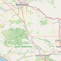
Exact coordinates of the repeater are known.
Coverage circle does not account for propagation anomalies or terrain.

Add a Propagation Report

- Base - HT - Mobile
Click the icons on map for details.


Date Information Updated
2021-01-29 16:26:42 I-5 coverage added.
2021-01-29 16:26:42 I-15 coverage added.
2021-01-29 16:26:42 I-10 coverage added.
2010-09-08 00:00:00 Located at Temple Hill


If you have an iPhone/iPod/iPad or Android device, please download the FREE official RepeaterBook app!


Copyright © 2006-2025 RepeaterBook.com. All Rights Reserved.
Created and owned by KD6KPC/WREQ745 since 2006.
All data, including non-copyrightable data, is protected from theft under Oregon law (ORS 164.377).

Page created in 0.044904 seconds.