| Downlink: | 145.11000 |
| Uplink: | 144.51000 |
| Offset: | -0.600 MHz |
| DMR Enabled | |
| Color Code: | 3 |
| DMR ID: |
312594 IPSC Network: BM - Color Code: 3 - TS Linked: TS1 - Trustee: Time Slot # 1 - 3129 = Missouri Time Slot # 1 - 31291 = SW Missouri Time Slot # 1 - 31296 = Central Missouri Time Slot # 2 - 312594 = LOCAL Time Slot # 1 - 3148444 = ? Information courtesy of radioid.net and the BrandMeister Network. Repeater trustees can directly update this data through their respective websites. |
| IPSC: | BrandMeister US |
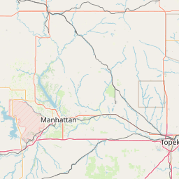
| County: | Benton |
| Grid: | EM38kj |
| Call: | KE0CYW |
| Use: | OPEN |
| Op Status: | |
| Coverage: |
30 mi radius. |
| Last updated: 2021-08-25 | |
| Last reviewed: 2024-04-06 | |


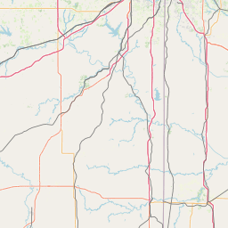

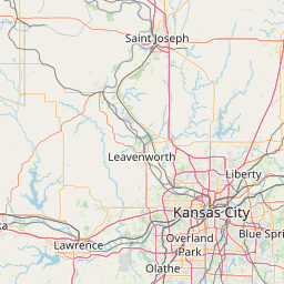

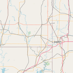

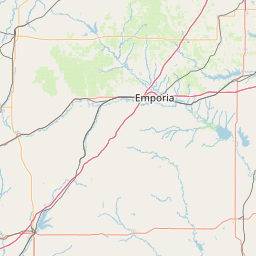


Exact coordinates of the repeater are known.
Coverage circle does not account for propagation anomalies or terrain.
| Click the icons on map for details. | ||
| Searches | Stats | Wiki | Account | About | |
| D-Star Repeaters | Overall Stats | Start Page | Log in | Contact Us | |
| DMR Repeaters | Current Status | Subscriptions | FAQs | ||
| P-25 Repeaters | Newsletter | Legal | |||
| Proximity 2.0 | Ad Free |
| Stay Connected |
|
|
Copyright © 2006-2025 RepeaterBook.com. All Rights Reserved.
Created and owned by KD6KPC/WREQ745 since 2006.
All data, including non-copyrightable data, is protected from theft under Oregon law (ORS 164.377).
