(1 of 9) ...The Flood Warning continues for the following river in Arkansas... Fourche Lafave River Near Houston affecting Perry County. For the Fourche Lafave River...including Houston, Gravelly...Minor flooding is forecast. * WHAT...Minor flooding is occurring and minor flooding is forecast. * WHERE...Fourche Lafave River near Houston. * WHEN...Until early Sunday afternoon. * IMPACTS...At 25.0 feet, Agricultural lands along the Arkansas River and up into the Fourche LaFave begin to flood. Equipment and livestock should be moved to higher ground. * ADDITIONAL DETAILS... - At 8:30 PM CDT Tuesday the stage was 25.2 feet. - Forecast...The river is expected to rise to a crest of 26.6 feet early Thursday afternoon (May 29). - Flood stage is 25.0 feet. - http://www.weather.gov/safety/flood (2 of 9) ...The Flood Warning continues for the following rivers in Louisiana...Arkansas... Bayou Dorcheat Near Springhill affecting Webster and Columbia Parishes. For the Bayou Dorcheat...including Springhill, Dixie Inn, Lake Bistineau...Minor flooding is forecast. * WHAT...Minor flooding is occurring and minor flooding is forecast. * WHERE...Bayou Dorcheat near Springhill. * WHEN...Until further notice. * IMPACTS...At 13.0 feet, Minor lowland flooding of private boat ramps. Move livestock to higher ground. * ADDITIONAL DETAILS... - At 8:00 PM CDT Tuesday the stage was 11.6 feet. - Bankfull stage is 11.0 feet. - Recent Activity...The maximum river stage in the 24 hours ending at 8:00 PM CDT Tuesday was 11.6 feet. - Forecast...The river is expected to rise to a crest of 12.5 feet Friday morning. - Flood stage is 11.0 feet. - Flood History...This crest compares to a previous crest of 12.4 feet on 11/22/2015. - http://www.weather.gov/safety/flood (3 of 9) ...The Flood Warning continues for the following rivers in Louisiana...Arkansas... Ouachita River At Felsenthal Lock and Dam affecting Ashley, Morehouse and Union Parishes. For the Ouachita River...including Felsenthal Lock and Dam, Monroe, Columbia...Minor flooding is forecast. * WHAT...Minor flooding is forecast. * WHERE...Ouachita River at Felsenthal Lock and Dam. * WHEN...From Sunday morning until further notice. * ADDITIONAL DETAILS... - At 7:30 PM CDT Tuesday the stage was 69.5 feet. - Bankfull stage is 65.0 feet. - Forecast...The river is expected to rise above flood stage Sunday morning and continue rising to 74.0 feet Sunday, June 08. Additional rises are possible thereafter. - Flood stage is 70.0 feet. - Flood History...This crest compares to a previous crest of 73.5 feet on 03/13/1994. - http://www.weather.gov/safety/flood (4 of 9) ...The Flood Warning continues for the following river in Arkansas... Ouachita River At Camden affecting Calhoun and Ouachita Counties. For the Ouachita River...including Jones Mill Dcp, Arkadelphia, Camden, Thatcher L&D...Minor flooding is forecast. * WHAT...Minor flooding is occurring and minor flooding is forecast. * WHERE...Ouachita River at Camden. * WHEN...Until further notice. * IMPACTS...At 26.0 feet, Low lying pastures and timber land along the river begins to flood. Sandy Beach Park at Camden starts to flood. At 28.0 feet, Sandy Beach Park and portions of the Riverwalk area off of Washington Street are inundated. State Highway 7 off 79B becomes inundated. At 30.0 feet, State Highway 7 north of Camden floods, with detours nearby. Portions of Sandy Beach Park will flood. Some county roads north and east of Camden begin to flood. At 34.0 feet, Overbank flooding closes many roads. Harmony Grove community has flood problems at this stage. Many low lying roads are flooding with access to some residential areas by boat only. * ADDITIONAL DETAILS... - At 7:30 PM CDT Tuesday the stage was 26.6 feet. - Forecast...The river is expected to rise to a crest of 33.1 feet Sunday morning (June 1). - Flood stage is 26.0 feet. - http://www.weather.gov/safety/flood (5 of 9) ...The Flood Warning continues for the following river in Arkansas... White River At Clarendon affecting Monroe and Arkansas Counties. For the Lower White River...including Newport, Augusta, Georgetown, Des Arc, Clarendon...Minor flooding is forecast. * WHAT...Minor flooding is occurring and minor flooding is forecast. * WHERE...White River at Clarendon. * WHEN...Until further notice. * IMPACTS...At 26.0 feet, River flows in many side channels and creates islands between the river and sloughs and creeks. Flooding of cropland and timber is occurring. Portions of the National Wildlife Refuge downstream of Clarendon flooding. * ADDITIONAL DETAILS... - At 8:00 PM CDT Tuesday the stage was 26.9 feet. - Forecast...The river is expected to rise to a crest of 27.0 feet tomorrow evening (May 28). - Flood stage is 26.0 feet. - http://www.weather.gov/safety/flood (6 of 9) ...The Flood Warning continues for the following river in Arkansas... Cache River Near Patterson affecting Woodruff and Jackson Counties. For the Cache River...including Patterson...Minor flooding is forecast. * WHAT...Minor flooding is occurring and minor flooding is forecast. * WHERE...Cache River near Patterson. * WHEN...Until further notice. * IMPACTS...At 8.0 feet, Low swampy timberland along the river begins to flood. At 9.0 feet, Low swampy timberland along the river begins to flood. Flood gates should be closed and equipment moved out of the low grounds along the river and tributaries. At 10.0 feet, Pastureland and cropland not protected by levees in Jackson and Woodruff counties affected. Water is over portions of State Highway 37 and deep along the shoulders of State Highway 18 near Grubbs. Water over portions of Woodruff County Road 775 north of State Highway 260. At 10.5 feet, Water deep over Woodruff County Road 775 north of HWY 260, and intersection of HWY 37 and HWY 18 east of Grubbs. Water is encroaching on yards of homes on Pine Street in Patterson. Many acres of cropland, pastures, and timber flooded in Jackson and Woodruff counties. * ADDITIONAL DETAILS... - At 7:15 PM CDT Tuesday the stage was 10.5 feet. - Forecast...The river is expected to rise to a crest of 10.6 feet tomorrow morning (May 28). - Flood stage is 9.0 feet. - http://www.weather.gov/safety/flood (7 of 9) ...The Flood Warning continues for the following river in Arkansas... Black River At Black Rock affecting Jackson, Independence and Lawrence Counties. For the Black River...including Corning, Pocahontas, Black Rock... Minor flooding is forecast. * WHAT...Minor flooding is occurring and minor flooding is forecast. * WHERE...Black River at Black Rock. * WHEN...Until late Sunday evening. * IMPACTS...At 14.0 feet, Minor flooding begins. Farm ground along east bank begins to flood. At 17.0 feet, Low lying cultivated land and pastures in Lawrence, Jackson, and Independence counties flood. At 20.0 feet, Agricultural land is flooding along both banks of the river in Lawrence, Independence, and Jackson counties. Minor flooding in Powhatan Community and Courthouse State Park. * ADDITIONAL DETAILS... - At 7:00 PM CDT Tuesday the stage was 21.1 feet. - Forecast...The river is expected to fall to a stage of 17.9 feet on Thursday evening (May 29), but remain in minor flood stage. - Flood stage is 14.0 feet. - http://www.weather.gov/safety/flood (8 of 9) ...The Flood Warning continues for the following river in Arkansas... White River At Augusta affecting Woodruff and White Counties. For the Lower White River...including Newport, Augusta, Georgetown, Des Arc, Clarendon...Minor flooding is forecast. * WHAT...Minor flooding is occurring and minor flooding is forecast. * WHERE...White River at Augusta. * WHEN...Until further notice. * IMPACTS...At 26.0 feet, Farm ground along the river in White and Woodruff counties begin to flood. Seasonal agricultural impacts. At 28.0 feet, Roads in Henry Gray Hurricane Lake Wildlife Management area flooded. Thousands of acres of cultivated land flooded in White and Woodruff counties. At 30.0 feet, Thousands of acres of farm ground flooded. County roads on both sides of the river are flooded, including County Road 871 and 899. At 32.0 feet, Thousands of acres of cropland and farm roads are flooded in White and Woodruff counties. Water is isolating homes and camps along the river in White and Woodruff counties. * ADDITIONAL DETAILS... - At 7:00 PM CDT Tuesday the stage was 31.3 feet. - Forecast...The river is expected to rise to a crest of 32.0 feet early Saturday morning (May 31). - Flood stage is 26.0 feet. - http://www.weather.gov/safety/flood (9 of 9) ...The Flood Warning is extended for the following river in Arkansas... Ouachita River At Thatcher L&D affecting Bradley, Calhoun and Union Counties. For the Ouachita River...including Jones Mill Dcp, Arkadelphia, Camden, Thatcher L&D...Minor flooding is forecast. * WHAT...Minor flooding is forecast. * WHERE...Ouachita River at Thatcher L&D. * WHEN...From this evening until further notice. * IMPACTS...At 79.0 feet, Property in low lying areas needs to be removed. Access roads to oil and gas rigs may be flooded. Levee gates should be closed before the river reaches 80 feet. There is minor flooding at this level. At 80.0 feet, Minor flooding occurs at this level. Levee gates should be closed to prevent the river from backing into Calion Lake. Access to oil and gas rigs and to timber is flooded. There is wide coverage of flooding in the river bottoms. At 83.0 feet, Access to oil and gas rigs and to timber is flooded. Calhoun County Road 131 is completely under water leading to old Lock 8 river access. At 85.0 feet, There may be some County roads along the river flooded, requiring lengthy detours. River is high and swift, boaters should be very cautious. Access to many oil and gas rigs will be by boat only. Levee gates should be closed. * ADDITIONAL DETAILS... - At 7:30 PM CDT Tuesday the stage was 79.0 feet. - Forecast...The river is expected to continue rising to 85 feet on Monday (June 2) remaining in minor flood stage over this timeframe; however, additional rises are possible. - Flood stage is 79.0 feet. - http://www.weather.gov/safety/flood
honey pot Blytheville, Nucor Tower, Arkansas, 444.175, KG5A Repeater

Nucor Tower - KG5A

Blytheville, AR
Repeater ID: 05-20144

Downlink: 444.17500
Uplink: 449.17500
Offset: +5.000 MHz
DMR Enabled
Color Code: 1
DMR ID: 312873
IPSC Network: Brandmeister - Color Code: 1 - TS Linked: TS1 TS2 - Trustee: radio id dot net antenna logo NJ8X
No talkgroup data found.Serving the Blytheville, AR, NE Arkansas, SE Missouri, NW Tennessee Region. ** DO NOT** dynamically link on ANY timeslot without emergency traffic. TS2/TG2 is for normal amateur conversations in West TN area. External TG for hotspots is 314710 - do NOT use this TG via the repeater! TS1/TG2 is West TN Mutual AID. This TG is for any mutual aid situation (not limited to weather events).
Both Slots Linked
Last seen: 2025-05-28 11:34:13

Information courtesy of radioid.net and the BrandMeister Network. Repeater trustees can directly update this data through their respective websites.
IPSC: BrandMeister US
County: Mississippi
Call: KG5A
Use: OPEN
Op Status: ON-AIR On-Air
Coverage: NE Ark, NW Tenn, SE Missouri
Sponsor: Hickman Amateur Radio Club
Features: TS2/TG2 (West TN Talk) TS1/TG1: West TN Mutual AID for emergencies
Emergency power equipped.
Links:
System Links:
Full-time internet linked to the West TN Mutual Aid System.
Full-time internet linked to the West TN Talk System.
Nets: Net Every Wednesday at 20:00 local time on TS2/TG2.
Web links:
Coordination: ARC
Last updated: 2022-05-15
Last reviewed: 2025-04-13
Marker
30 km
30 mi
Leaflet © OSM contributors

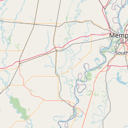
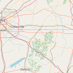
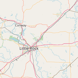
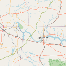
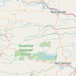
Exact coordinates of the repeater are not known.
Coverage circle based on mobile coverage and ignores propagation anomalies and terrain.

Signal Reports (click map icon for details): Base Mobile HT
Add a Signal Report


Date Information Updated
2024-01-16 09:42:30 Added local DMR network: BrandMeister US

Call Date Details
NJ8X (registered) 2025-04-09 Updated Talk groups and net
KX4MQ 2024-08-25 Updated coverage area.
KX4MQ 2024-06-23 Updated DMR Credentials, website, misc.
N9EXR (registered) 2023-11-10 Reported on-air.


Visit our DMR pages | Learn more about DMR | NetWatch

- DMR Talk groups are updated directly on radioid.net or BrandMeister.network.
- The IPSC Network is obtained from the radioid.net API. If this information is not correct, please update it at radioid.net.
- Did you know that Repeaterbook has its own BrandMeister talk group? Find us at 31419 (BrandMeister only).