(1 of 6) ...The Flood Warning continues for the following rivers in Texas... South Sulphur River Near Cooper affecting Delta and Hopkins Counties. * WHAT...Minor flooding is occurring and minor flooding is forecast. * WHERE...South Sulphur River near Cooper. * WHEN...Until late Wednesday evening. * IMPACTS...At 16.0 feet, Minor out of bank flooding will occur. A few rural roads will begin to flood. Minor flooding will occur to farm and ranch land adjacent to the river. * ADDITIONAL DETAILS... - At 9:15 AM CDT Monday the stage was 16.3 feet. - Bankfull stage is 16.0 feet. - Flood stage is 16.0 feet. - Forecast...The river is expected to rise to a crest of 16.3 feet this afternoon. It will then fall below flood stage late Wednesday morning. (2 of 6) ...The Flood Warning continues for the following rivers in Texas... Angelina River Near Lufkin affecting Cherokee, Nacogdoches and Angelina Counties. For the Angelina River...including Alto, Lufkin...Minor flooding is forecast. * WHAT...Minor flooding is occurring and minor flooding is forecast. * WHERE...Angelina River near Lufkin. * WHEN...Until further notice. * IMPACTS...At 162.0 feet, Minor lowland to diminish and end on the lower Angelina River. * ADDITIONAL DETAILS... - At 8:45 AM CDT Monday the stage was 163.2 feet. - Bankfull stage is 158.5 feet. - Recent Activity...The maximum river stage in the 24 hours ending at 8:45 AM CDT Monday was 163.3 feet. - Forecast...The river is expected to rise to a crest of 163.3 feet this afternoon. - Flood stage is 161.0 feet. - Flood History...No available flood history. - http://www.weather.gov/safety/flood (3 of 6) ...The Flood Warning continues for the following rivers in Texas... Neches River Near Neches affecting Cherokee, Houston and Anderson Counties. For the Neches River...including Lake Palestine, Neches, Alto, Diboll, Rockland...Minor flooding is forecast. * WHAT...Minor flooding is occurring and minor flooding is forecast. * WHERE...Neches River near Neches. * WHEN...Until Friday morning. * IMPACTS...At 14.0 feet, Minor lowland flooding. Move livestock and equipment to higher ground away from the river. * ADDITIONAL DETAILS... - At 8:30 AM CDT Monday the stage was 13.0 feet. - Bankfull stage is 12.0 feet. - Recent Activity...The maximum river stage in the 24 hours ending at 8:30 AM CDT Monday was 13.4 feet. - Forecast...The river is expected to fall below flood stage early Thursday afternoon and continue falling to 11.3 feet Saturday morning. - Flood stage is 12.0 feet. - Flood History...This crest compares to a previous crest of 13.3 feet on 01/20/2017. - http://www.weather.gov/safety/flood (4 of 6) ...The Flood Warning continues for the following rivers in Texas... Sabine River Near Gladewater affecting Wood, Upshur, Gregg and Smith Counties. For the Sabine River...including Gladewater...Minor flooding is forecast. * WHAT...Minor flooding is occurring and minor flooding is forecast. * WHERE...Sabine River near Gladewater. * WHEN...Until late Thursday night. * IMPACTS...At 29.0 feet, Expect lowland flooding to continue with oil field operations curtailed. * ADDITIONAL DETAILS... - At 8:15 AM CDT Monday the stage was 29.6 feet. - Bankfull stage is 25.0 feet. - Recent Activity...The maximum river stage in the 24 hours ending at 8:15 AM CDT Monday was 29.7 feet. - Forecast...The river is expected to fall below flood stage late Thursday morning and continue falling to 21.7 feet Saturday morning. - Flood stage is 26.0 feet. - http://www.weather.gov/safety/flood (5 of 6) ...The Flood Warning is extended for the following rivers in Texas... Sabine River Near Hawkins affecting Upshur, Wood and Smith Counties. For the Sabine River...including Hawkins...Minor flooding is forecast. * WHAT...Minor flooding is occurring and minor flooding is forecast. * WHERE...Sabine River near Hawkins. * WHEN...Until Tuesday morning. * IMPACTS...At 23.0 feet, Minor lowland flooding. Move livestock and equipment to higher ground. * ADDITIONAL DETAILS... - At 7:45 AM CDT Monday the stage was 23.9 feet. - Bankfull stage is 22.0 feet. - Recent Activity...The maximum river stage in the 24 hours ending at 7:45 AM CDT Monday was 24.7 feet. - Forecast...The river is expected to fall below flood stage tonight and continue falling to 15.3 feet Saturday morning. - Flood stage is 23.0 feet. - http://www.weather.gov/safety/flood (6 of 6) ...The Flood Warning continues for the following rivers in Texas... Sabine River Near Mineola affecting Wood and Smith Counties. For the Sabine River...including Mineola...Minor flooding is forecast. * WHAT...Minor flooding is occurring and minor flooding is forecast. * WHERE...Sabine River near Mineola. * WHEN...Until Thursday evening. * IMPACTS...At 16.0 feet, Expect flooding of low river bottoms with secondary roadways along with picnic and recreational areas becoming inundated as well. Ranchers should move cattle and equipment to higher ground. * ADDITIONAL DETAILS... - At 8:15 AM CDT Monday the stage was 16.0 feet. - Bankfull stage is 14.0 feet. - Recent Activity...The maximum river stage in the 24 hours ending at 8:15 AM CDT Monday was 16.4 feet. - Forecast...The river is expected to fall below flood stage early Thursday morning and continue falling to 11.4 feet Saturday morning. - Flood stage is 14.0 feet. - http://www.weather.gov/safety/flood
RepeaterBook.com Home Page
honey pot McAllen, Rio Grande Reg Hospital, Texas, 443.825, KC5MOL Repeater

Rio Grande Reg Hospital - KC5MOL

McAllen, TX
Repeater ID: 48-20129

Downlink: 443.82500
Uplink: 448.82500
Offset: +5.000 MHz
DMR Enabled
Color Code: 1
DMR ID: 311965
IPSC Network: BM - Color Code: 1 - TS Linked: TS1 TS2 - Trustee: radio id dot net antenna logo KC5MOL
Time Slot # 1 - 3148 = Texas
Time Slot # 2 - 31482 = South Texas
Time Slot # 1 - 315818 = ?
MMDVM Rpter
Both Slots Linked
Last seen: 2025-04-12 21:48:06

Information courtesy of radioid.net and the BrandMeister Network. Repeater trustees can directly update this data through their respective websites.
IPSC: BrandMeister US
County: Hidalgo
Call: KC5MOL
Use: OPEN
Op Status: ON-AIR On-Air
Coverage: McAllen, Edinburg, Mission, Pharr, San Juan, Alamo, Mercedes
Last updated: 2021-09-05
Last reviewed: 2024-01-15
50 km
30 mi
Leaflet | © OpenStreetMap, © OpenStreetMap contributors

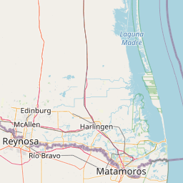
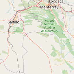
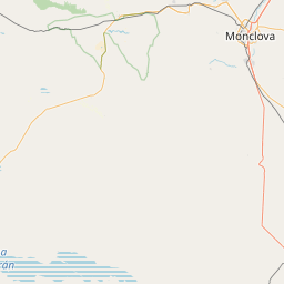
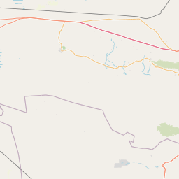
Exact coordinates of the repeater are not known. Location is approximate.

Add a Propagation Report

- Base - HT - Mobile
Click the icons on map for details.


Date Information Updated
2024-01-15 17:56:47 Added local DMR network: BrandMeister US

Call Date Information
KC5MOL (registered) 2021-06-19 Added.


Visit our DMR pages | Learn more about DMR | NetWatch

- DMR Talk groups are updated directly on radioid.net or BrandMeister.network.
- The IPSC Network is obtained from the radioid.net API. If this information is not correct, please update it at radioid.net.
- Did you know that Repeaterbook has its own BrandMeister talk group? Find us at 31419 (BrandMeister only).


Copyright © 2006-2025 RepeaterBook.com. All Rights Reserved.
Created and owned by KD6KPC/WREQ745 since 2006.
All data, including non-copyrightable data, is protected from theft under Oregon law (ORS 164.377).

Page created in 1.261855 seconds.