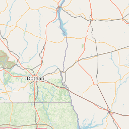
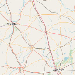
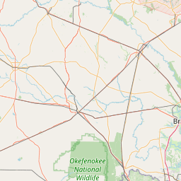
(1 of 6) * WHAT...Minor flooding is forecast. * WHERE...Ogeechee River at Midville. * WHEN...From late tonight to late Sunday night. * IMPACTS...At 6.0 feet, the access road into the River Bluff community in Midville floods. The lower portion of Johnson Road near Herndon is also flooded. * ADDITIONAL DETAILS... - At 900 PM EDT Wednesday, the stage was 5.9 feet. - Forecast...The river is expected to rise above flood stage early Thursday morning to a crest of 6.4 feet Friday evening. It will then fall below flood stage early Sunday afternoon. - Flood stage is 6.0 feet. (2 of 6) * WHAT...Minor flooding is forecast. * WHERE...Savannah River at Burtons Ferry. * WHEN...Until late Thursday night. * IMPACTS...At 15.0 feet, flooding of some adjacent agricultural lands occurs. Most boat ramps along the river are unusable. * ADDITIONAL DETAILS... - At 845 PM EDT Wednesday, the stage was 14.7 feet. - Forecast...The river is expected to rise to a crest of 15.0 feet Thursday morning. It will then fall below flood stage early Thursday afternoon. - Flood stage is 15.0 feet. (3 of 6) * WHAT...Moderate flooding is occurring and minor flooding is forecast. * WHERE...Canoochee River near Claxton. * WHEN...Until Sunday afternoon. * IMPACTS...At 13.5 feet, Hillside Drive, the main access road into Canoochee Properties, will be flooded. * ADDITIONAL DETAILS... - At 915 PM EDT Wednesday, the stage was 13.6 feet. - Forecast...The river is expected to fall below flood stage early Sunday morning and continue falling to 9.8 feet Monday evening. - Flood stage is 11.0 feet. (4 of 6) * WHAT...Minor flooding is forecast. * WHERE...Ogeechee River near Eden. * WHEN...From Thursday morning until further notice. * IMPACTS...At 12.0 feet, water encroaches on some homes along Dashers Landing Road and Yarbrough Landing Road. Davis Landing Road also becomes impassable. * ADDITIONAL DETAILS... - At 930 PM EDT Wednesday, the stage was 10.6 feet. - Forecast...The river is expected to rise above flood stage late Thursday morning and continue rising to a crest of 11.8 feet Saturday morning. - Flood stage is 11.0 feet. (5 of 6) * WHAT...Minor flooding is occurring and minor flooding is forecast. * WHERE...Savannah River near Clyo. * WHEN...Until further notice. * IMPACTS...At 13.3 feet, one foot of water covers Tom Goethe Road just after the pavement ends. * ADDITIONAL DETAILS... - At 915 PM EDT Wednesday, the stage was 11.3 feet. - Forecast...The river is expected to rise to a crest of 13.2 feet Saturday morning. - Flood stage is 11.0 feet. (6 of 6) * WHAT...Moderate flooding is occurring and moderate flooding is forecast. * WHERE...Ohoopee River near Reidsville. * WHEN...Until further notice. * IMPACTS...At 19.0 feet, the access road into the Joy Bluff community is covered with 1.5 feet of water. * ADDITIONAL DETAILS... - At 900 PM EDT Wednesday, the stage was 18.4 feet. - Forecast...The river is expected to fall to 11.5 feet Monday evening. - Flood stage is 11.0 feet.
honey pot Moultrie, Georgia, 146.79, WD4KOW Repeater

Moultrie, GA

WD4KOW
Repeater ID: 13-182

Downlink: 146.79000
Uplink: 146.19000
Offset: -0.600 MHz
Uplink Tone: 141.3
County: Colquitt
Call: WD4KOW
Use: OPEN
Op Status: ON-AIR On-Air
Coverage: 
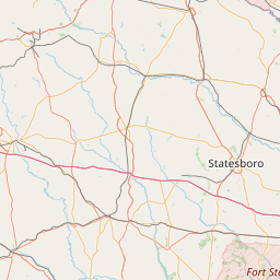
Estimated Area Coverage:
21 mi radius.
Antenna (AGL): 490 feet
Pattern: Omnidirectional
FM: Yes; analog capable: 25.0 kHz (wideband)
Links:
System Links:
Full-time to the Tall Pines Intertie System.
Notes: SERA Listing (as of 24 October 2023): This repeater (was previously, but) is no longer listed in the SERA online database.

RB: Current Repeater Record Custodians (RRCs) for WD4KOW 146.79000 Moultrie repeater (13-182): W1RCP.

Call sign AA4P was previously assigned to the Colquitt County Ham Radio Society in honor of long-time member and friend J.D. Goins who is now SK. This call was primarily used for the club's long time VHF repeater located in Moultrie, GA.
Nets: Friendly Net: Tuesdays at 20:30 (8:30 PM Eastern Time).

Monthly Club Meeting on the 3rd Saturday of each month at the Friendship Aliance Church on 26th Avenue at 08:30 (8:30 AM) Eastern Time.
Web links: Sponsor: W1RCP Blog .
Sponsor: COLQUITT COUNTY HAM RADIO SOCIETY (CCHRS).
Coordination: SERA
Last updated: 2023-04-26
Last reviewed: 2024-12-08
MarkerMarker
50 km
30 mi
Leaflet © OSM contributors

Exact coordinates of the repeater are not known.
Coverage circle based on mobile coverage and ignores propagation anomalies and terrain.

Signal Reports (click map icon for details): Base Mobile HT
Add a Signal Report


Call Date Details
W1RCP (registered) 2024-12-08 Reported no changes

(member) on 2023-10-29.

During a band opening I copied "AA4P" as the callsign of a repeater (146.7900 -0.6 MHz 141.3 Moultrie US GA AA4P OPEN ON-AIR). After looking up the call sign (in QRZ) I found AA4P in Clearwater, FL (AA4P -- PATRICK M. MURRAY -- 225 N. Hillcrest Dr. -- Clearwater, FL 33755 -- USA. Then I looked up repeaters within 200 miles of me and I found your repeater with a note that AA4P was a Silent Key (SK) member there. (According to the FCC) The AA4P callsign is now assigned to a guy in Clearwater FL. I may be wrong, but the IDer on this repeater sends "AA4P" as an ID. Please check your CW ID on your repeater 146.79 (MHz). RB EDITOR NOTE: Call sign AA4P was previously assigned to the Colquitt County Ham Radio Society (CCHRS) in honor of a long-time member and friend J.D. Goins who is now Silent Key (SK). This call was primarily used for the club's long time VHF repeater located in Moultrie, GA. It is sometimes used in contests as well as other events per the Club Trustee. https://www.findagrave.com/memorial/228259306/joel-dawson-goings?createdMemorial=Yes

Category Definitions
Comments
Coverage
Activity
Travel
"AA4P Call Sign Confusion & Explanation "
Posted by: AB4KK