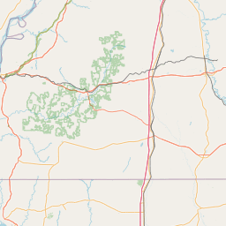
(1 of 6) ...The National Weather Service in Shreveport has issued a Flood Warning for the following rivers in Texas... Rabbit Creek At Kilgore affecting Gregg County. For the Rabbit Creek...including Kilgore...Minor flooding is forecast. * WHAT...Minor flooding is forecast. * WHERE...Rabbit Creek at Kilgore. * WHEN...From this evening to Sunday afternoon. * IMPACTS...At 12.0 feet, Expect flooded trails and a private boat launch. * ADDITIONAL DETAILS... - At 12:45 PM CDT Thursday the stage was 4.7 feet. - Bankfull stage is 10.0 feet. - Forecast...The river is expected to rise above flood stage late this evening to a crest of 11.9 feet Friday morning. It will then fall below flood stage early Saturday morning. - Flood stage is 10.0 feet. - http://www.weather.gov/safety/flood (2 of 6) ...The Flood Warning is extended for the following rivers in Texas... Cowleech Fork Sabine River At Greenville affecting Hunt County. * WHAT...Minor flooding is forecast. * WHERE...Cowleech Fork Sabine River at Greenville. * WHEN...Until late Saturday evening. * IMPACTS...At 17.0 feet, Moderate out of bank flooding will occur. A few rural roads closures will be needed along the river reach. Moderate flooding will occur along the river through Greenville. * ADDITIONAL DETAILS... - At 12:45 PM CDT Thursday the stage was 9.2 feet. - Bankfull stage is 14.0 feet. - Flood stage is 14.0 feet. - Forecast...The river is expected to rise above flood stage tomorrow afternoon to a crest of 16.6 feet early Saturday morning. It will then fall below flood stage late Saturday morning. (3 of 6) ...The Flood Warning is extended for the following rivers in Texas... White Oak Creek Near Talco affecting Titus, Morris and Franklin Counties. For the White Oak Creek...including Talco...Minor flooding is forecast. * WHAT...Minor flooding is forecast. * WHERE...White Oak Creek near Talco. * WHEN...From Saturday morning until further notice. * IMPACTS...At 18.0 feet, Minor lowland flooding. Move livestock and equipment to higher ground. * ADDITIONAL DETAILS... - At 9:30 AM CDT Thursday the stage was 4.4 feet. - Bankfull stage is 16.0 feet. - Forecast...The river is expected to rise above flood stage late Saturday morning and continue rising to 18.0 feet early Tuesday morning. Additional rises are possible thereafter. - Flood stage is 16.0 feet. - http://www.weather.gov/safety/flood (4 of 6) ...The Flood Warning is extended for the following rivers in Texas... Sulphur River Near Talco affecting Red River, Titus, Morris and Franklin Counties. For the Sulphur River...including Talco...Minor flooding is forecast. * WHAT...Minor flooding is forecast. * WHERE...Sulphur River near Talco. * WHEN...From Saturday afternoon until further notice. * IMPACTS...At 25.0 feet, Expect minor flooding of lowland areas with some secondary roadways closed. All cattle and equipment nearby the river should be moved to higher ground. * ADDITIONAL DETAILS... - At 9:45 AM CDT Thursday the stage was 13.1 feet. - Bankfull stage is 20.0 feet. - Forecast...The river will rise above flood stage Saturday afternoon to 25.0 feet Monday morning. - Flood stage is 20.0 feet. - http://www.weather.gov/safety/flood (5 of 6) ...The Flood Warning is extended for the following rivers in Texas... Attoyac Bayou Near Chireno affecting Shelby, Rusk, Nacogdoches and San Augustine Counties. For the Attoyac Bayou...including Chireno...Minor flooding is forecast. * WHAT...Minor flooding is occurring and minor flooding is forecast. * WHERE...Attoyac Bayou near Chireno. * WHEN...Until Sunday evening. * IMPACTS...At 19.0 feet, Expect minor lowland flooding of boat ramps and pastures. Move livestock and equipment to higher ground. * ADDITIONAL DETAILS... - At 7:30 AM CDT Thursday the stage was 17.7 feet. - Bankfull stage is 14.0 feet. - Recent Activity...The maximum river stage in the 24 hours ending at 7:30 AM CDT Thursday was 19.3 feet. - Forecast...The river is expected to rise to a crest of 18.0 feet this afternoon. It will then fall below flood stage early Sunday morning. - Flood stage is 14.0 feet. - http://www.weather.gov/safety/flood (6 of 6) ...The Flood Warning continues for the following rivers in Texas... Angelina River Near Lufkin affecting Angelina and Nacogdoches Counties. For the Angelina River...including Lufkin...Minor flooding is forecast. * WHAT...Minor flooding is occurring and minor flooding is forecast. * WHERE...Angelina River near Lufkin. * WHEN...Until further notice. * IMPACTS...At 165.0 feet, Expect flooding to continue for several days with the majority of the gravel access roadway flooded. Boaters and four wheel-operators should use caution traversing both upstream and downstream on the Angelina River as currents can become swift and turbulent. * ADDITIONAL DETAILS... - At 7:45 AM CDT Thursday the stage was 162.8 feet. - Bankfull stage is 158.5 feet. - Recent Activity...The maximum river stage in the 24 hours ending at 7:45 AM CDT Thursday was 162.8 feet. - Forecast...The river is expected to rise to a crest of 164.1 feet Sunday morning. - Flood stage is 161.0 feet. - http://www.weather.gov/safety/flood
RepeaterBook.com Home Page
honey pot Beaumont, Texas, 146.94, W5APX Repeater

Beaumont, TX

W5APX
Repeater ID: 48-13452

Downlink: 146.94000
Uplink: 146.34000
Offset: -0.600 MHz
Uplink Tone: 100.0
Downlink Tone: 100.0
County: Orange
Grid: EM20xc
Call: W5APX
Use: OPEN
Op Status: ON-AIR On-Air
Coverage: Estimated Area Coverage: Winnie, TX to Lake Charles, LA (W/E); Sabine Pass, TX to Kirbyville and Woodville (N/S) Major highways include: I-10; US 69/96/287.
Pattern: Omnidirectional
Sponsor: Triangle Rptr Association
Features: Member of Crossroads Repeater link system, W5LCR. Still carries East Coast Reflector nets at this time
Emergency power equipped - Battery/Generator
FM: Yes; analog capable.
Analog Bandwidth: 25.0 kHz (wideband)
Links:
System Links:
Full-time internet linked to the Cross Roads Ham Radio Club Link System.
AllStar: 50991 👍 Uptime: 1d 17hr 28m 34s
Commands: DTMF Readback: * (asterisks) + 5 + digits

Local Time (Central): * (asterisks) + 8 + 0)

Link Codes are available to Control Operators ONLY due to abuse by local operators.
Notes: TGVHFS Listing (as of 21 July 2023): 146.9400 VIDOR ORANGE W5APX 100.0elWX 2.

RB: Current Repeater Record Custodian (RRC) for W5APX 146.94000 Vidor repeater (48-13452): WB5ITT.

This repeater was coordinated 20 June 2018. Includes an RLC Club DLX II controller and a Kenwood TKR750 radio. W5APX put this repeater on one of the top five (5) 34/94 repeaters in the US in the 1960s in Port Arthur, TX.
Nets: East Coast Reflector nets at this time..then reconnects to Crossroads
Web links: Sponsor: WB5ITT -- CHRISTOPHER W, (CHRIS) BOONE -- TRUSTEE.
Sponsor: W5APX -- Triangle Repeater Association (TRA) .
Coordination: TVHFS
Last updated: 2025-03-22
Last reviewed: 2025-03-22
50 km
30 mi
Leaflet | © OpenStreetMap, © OpenStreetMap contributors

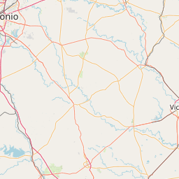
Exact coordinates of the repeater are not known. Location is approximate.

Add a Propagation Report

- Base - HT - Mobile
Click the icons on map for details.


Date Information Updated
2021-01-29 16:28:31 Added.

Call Date Details
WB5ITT (registered) 2025-03-20 Location updated
WB5ITT (registered) 2025-02-13 updated repeater link.


If you have an iPhone/iPod/iPad or Android device, please download the FREE official RepeaterBook app!


Copyright © 2006-2025 RepeaterBook.com. All Rights Reserved.
Created and owned by KD6KPC/WREQ745 since 2006.
All data, including non-copyrightable data, is protected from theft under Oregon law (ORS 164.377).

Page created in 0.232855 seconds.