(1 of 6) The National Weather Service in Amarillo has issued a Red Flag Warning for strong winds and low relative humidity, which is in effect from 1 PM this afternoon to 7 PM CDT this evening. * Affected Area...In Texas...Oldham and Deaf Smith. * 20 Foot Winds...Southwest 20.0 to 25.0 mph with gusts up to 40.0 mph. * Relative Humidity...As low as 10 percent. * Red Flag Threat Index...3 to 6. * Timing...From 1 PM to 7 PM. (2 of 6) ...RED FLAG WARNING IN EFFECT FROM 9 AM CDT /8 AM MDT/ THIS MORNING TO 10 PM CDT /9 PM MDT/ THIS EVENING FOR 20-FT WINDS OF 20 MPH OR MORE, RELATIVE HUMIDITY OF 15% OR LESS, AND HIGH TO VERY HIGH FIRE DANGER FOR SOUTHEAST NEW MEXICO AND MOST OF WEST TEXAS... ...FIRE WEATHER WATCH IN EFFECT FROM SATURDAY AFTERNOON THROUGH SATURDAY EVENING FOR 20-FT WINDS OF 20 MPH OR MORE, RELATIVE HUMIDITY OF 15% OR LESS, AND HIGH TO VERY HIGH FIRE DANGER FOR SOUTHEAST NEW MEXICO AND MOST OF WEST TEXAS... * WINDS...Southwest 20 to 30 mph with gusts up to 40 mph. * RELATIVE HUMIDITY...As low as 12 percent. * RFTI...4 or near critical. * IMPACTS...Avoid the use of open flames or any activities that may generate sparks. Accidental ignitions will have the potential to grow into dangerous wind-driven wildfires. Fires can start from the smallest of flames or sparks and are highly discouraged. Observe local burn bans. * SEVERITY... FUELS (ERC)...70th-89th percentile...4 (out of 5). WEATHER...Near Critical...2 (out of 5). FIRE ENVIRONMENT...6 (out of 10). (3 of 6) The National Weather Service in Lubbock has issued a Red Flag Warning, which is in effect from 10 AM this morning to 7 PM CDT this evening. The Fire Weather Watch is no longer in effect. * Timing...From 10 AM this morning to 7 PM CDT this evening. * Wind...Southwest at 25 to 30 mph with gusts up to 40 mph. * Humidity...As low as 12 percent. * Fuels...Dry. * Impacts...Any fires that develop can spread rapidly. Outdoor burning is discouraged. (4 of 6) ...The Flood Warning continues for the following rivers in Texas... Sabine River Near Mineola affecting Wood and Smith Counties. For the Sabine River...including Mineola, Gladewater...Minor flooding is forecast. * WHAT...Minor flooding is occurring and minor flooding is forecast. * WHERE...Sabine River near Mineola. * WHEN...Until late Friday night. * IMPACTS...At 14.0 feet, Expect flooding of secondary roadways with picnic and recreational areas flooded as well. Also expect flooded boat ramps as well. * ADDITIONAL DETAILS... - At 8:15 PM CDT Thursday the stage was 14.2 feet. - Bankfull stage is 14.0 feet. - Recent Activity...The maximum river stage in the 24 hours ending at 8:15 PM CDT Thursday was 14.9 feet. - Forecast...The river is expected to fall below flood stage tomorrow morning and continue falling to 10.8 feet Tuesday evening. - Flood stage is 14.0 feet. - http://www.weather.gov/safety/flood (5 of 6) ...The Flood Warning is extended for the following rivers in Texas... Angelina River Near Lufkin affecting Cherokee, Nacogdoches and Angelina Counties. For the Angelina River...including Lufkin...Minor flooding is forecast. * WHAT...Minor flooding is occurring and minor flooding is forecast. * WHERE...Angelina River near Lufkin. * WHEN...Until Monday afternoon. * IMPACTS...At 162.0 feet, Minor lowland to diminish and end on the lower Angelina River. * ADDITIONAL DETAILS... - At 8:45 PM CDT Thursday the stage was 162.2 feet. - Bankfull stage is 158.5 feet. - Recent Activity...The maximum river stage in the 24 hours ending at 8:45 PM CDT Thursday was 162.7 feet. - Forecast...The river is expected to fall below flood stage early Sunday morning and continue falling to 160.7 feet Tuesday evening. - Flood stage is 161.0 feet. - http://www.weather.gov/safety/flood (6 of 6) ...The Flood Warning is extended for the following rivers in Texas... Sabine River Near Gladewater affecting Wood, Upshur, Gregg and Smith Counties. For the Sabine River...including Mineola, Gladewater...Minor flooding is forecast. * WHAT...Minor flooding is occurring and minor flooding is forecast. * WHERE...Sabine River near Gladewater. * WHEN...Until Saturday morning. * IMPACTS...At 26.0 feet, Expect minor lowland flooding with camps and picnic areas near the river suffering some flooding. * ADDITIONAL DETAILS... - At 8:15 PM CDT Thursday the stage was 27.3 feet. - Bankfull stage is 25.0 feet. - Recent Activity...The maximum river stage in the 24 hours ending at 8:15 PM CDT Thursday was 28.3 feet. - Forecast...The river is expected to fall below flood stage tomorrow afternoon and continue falling to 15.8 feet Tuesday evening. - Flood stage is 26.0 feet. - http://www.weather.gov/safety/flood
RepeaterBook.com Home Page
honey pot Atascocita, Fire Sta 29, Texas, 443.55, W5SI Repeater

Fire Sta 29 - W5SI

Atascocita, TX
Repeater ID: 48-1270

Downlink: 443.55000
Uplink: 448.55000
Offset: +5.000 MHz
Uplink Tone: 103.5
System Fusion Enabled
DG-ID: 00 - Open
County: Harris
Call: W5SI
Use: OPEN
Op Status: ON-AIR On-Air
Coverage:
Sponsor: <a href="http://www.teac.net/teac-repeaters.html">Texas Emergency Amateur Communications</a>
Features: Emergency power equipped.
FM: Yes; analog capable.
Analog Bandwidth: 25.0 kHz (wideband)
Nets: Tuesday YSF/C4FM Ragchew., 20:00.
Coordination: TVHFS
Last updated: 2025-01-23
Last reviewed: 2025-01-23
50 km
30 mi
Leaflet | © OpenStreetMap, © OpenStreetMap contributors

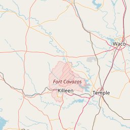
Exact coordinates of the repeater are not known. Location is approximate.

Add a Propagation Report

- Base - HT - Mobile
Click the icons on map for details.


Date Information Updated
2021-01-29 16:27:15 TX-8 coverage deleted.
2021-01-29 16:27:15 BW-8 coverage deleted.
2021-01-29 16:26:42 US-59 coverage added.
2021-01-29 16:26:42 TX-8 coverage added.
2021-01-29 16:26:42 TX-1960 coverage added.
2021-01-29 16:26:42 BW-8 coverage added.

Call Date Information
KD2QAR (registered) 2019-02-28 On-Air
W9NUQ 2015-03-23 Added C4FM
N5AMS (registered) 2011-01-27 Reported on-air.


Copyright © 2006-2025 RepeaterBook.com. All Rights Reserved.
Created and owned by KD6KPC/WREQ745 since 2006.
All data, including non-copyrightable data, is protected from theft under Oregon law (ORS 164.377).

Page created in 0.048331 seconds.