(1 of 2) ...The Flood Warning is extended for the following rivers in Michigan... Manistee River near Sherman affecting Wexford County. For the Manistee River...including Sherman...Minor flooding is forecast. * WHAT...Minor flooding is occurring and minor flooding is forecast. * WHERE...Manistee River near Sherman. * WHEN...Until Monday, April 07. * IMPACTS...At 16.0 feet, Flooding of property and homes adjacent to right bank of river along Ojibway Drive, Ottawa Drive, and Chippewa Drive 1 mile north of Sherman. Flooding of N11 Road between W14 Road and W16 Road 1 mile northwest of Mesick. * ADDITIONAL DETAILS... - At 7:30 PM EDT Monday the stage was 15.8 feet. - Bankfull stage is 14.0 feet. - Recent Activity...The maximum river stage in the 24 hours ending at 7:30 PM EDT Monday was 15.8 feet. - Forecast...The river is expected to crest near 15.8 feet tonight. It will then fall below flood stage Monday, April 07. - Flood stage is 15.0 feet. - Flood History...This crest compares to a previous crest of 15.7 feet on 03/29/1976. - http://www.weather.gov/safety/flood (2 of 2) ...The Flood Warning is extended for the following rivers in Michigan... Rifle River near Sterling affecting Arenac County. For the Rifle River...including Sterling...Minor flooding is forecast. * WHAT...Minor flooding is occurring and minor flooding is forecast. * WHERE...Rifle River near Sterling. * WHEN...Until early Saturday morning. * IMPACTS...At 9.0 feet, High water begins to impact campground at White's Canoe Livery at Melita Road bridge. * ADDITIONAL DETAILS... - At 7:30 PM EDT Monday the stage was 9.0 feet. - Bankfull stage is 4.5 feet. - Recent Activity...The maximum river stage in the 24 hours ending at 7:30 PM EDT Monday was 9.0 feet. - Forecast...The river will crest around 9.2 feet tonight. The river will fall below flood stage early Wednesday afternoon to 5.2 feet early Thursday morning. It will then rise above flood stage Thursday afternoon to 6.7 feet Friday morning. It will fall below flood stage again late Friday evening. - Flood stage is 6.0 feet. - Flood History...This crest compares to a previous crest of 9.2 feet on 04/06/1947. - http://www.weather.gov/safety/flood
RepeaterBook.com Home Page
honey pot Howell, Grand River/M-59, Michigan, 146.5, N8EOC Repeater

Grand River/M-59 - N8EOC

Howell, MI
Repeater ID: 26-10560

Downlink: 146.50000
Uplink: 147.50000
Offset: +1.000 MHz
Uplink Tone: 131.8
Downlink Tone: 131.8
County: Livingston
Grid: EN82AO
Call: N8EOC
Use: OPEN
Op Status: ON-AIR On-Air
Coverage: Limited coverage in and around the Livingston County area.
15 mi radius.
Sponsor: Livingston County ARES/RACES
Affiliate: Livingston Amateur Radio Klub (LARK)
FM: Yes; analog capable.
Analog Bandwidth: 25.0 kHz (wideband)
Notes: Shared Non-Protected Repeater (SNPR)
Last updated: 2023-05-06
Last reviewed: 2023-05-06
30 km
20 mi
Leaflet | © OpenStreetMap, © OpenStreetMap contributors

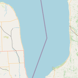
Exact coordinates of the repeater are known.
Coverage circle does not account for propagation anomalies or terrain.

Add a Propagation Report

- Base - HT - Mobile
Click the icons on map for details.


Date Information Updated
2021-01-29 16:28:31 Added.

Call Date Details
W8DSB (registered) 2023-05-03 The landmark changed to Grand River at M-59. The coordinates were changed. Email updated.


If you have an iPhone/iPod/iPad or Android device, please download the FREE official RepeaterBook app!


Copyright © 2006-2025 RepeaterBook.com. All Rights Reserved.
Created and owned by KD6KPC/WREQ745 since 2006.
All data, including non-copyrightable data, is protected from theft under Oregon law (ORS 164.377).

Page created in 0.036231 seconds.