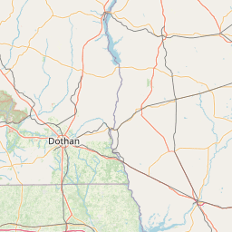
(1 of 6) * WHAT...Minor flooding is forecast. * WHERE...Ogeechee River at Midville. * WHEN...From late tonight to late Sunday night. * IMPACTS...At 6.0 feet, the access road into the River Bluff community in Midville floods. The lower portion of Johnson Road near Herndon is also flooded. * ADDITIONAL DETAILS... - At 900 PM EDT Wednesday, the stage was 5.9 feet. - Forecast...The river is expected to rise above flood stage early Thursday morning to a crest of 6.4 feet Friday evening. It will then fall below flood stage early Sunday afternoon. - Flood stage is 6.0 feet. (2 of 6) * WHAT...Minor flooding is forecast. * WHERE...Savannah River at Burtons Ferry. * WHEN...Until late Thursday night. * IMPACTS...At 15.0 feet, flooding of some adjacent agricultural lands occurs. Most boat ramps along the river are unusable. * ADDITIONAL DETAILS... - At 845 PM EDT Wednesday, the stage was 14.7 feet. - Forecast...The river is expected to rise to a crest of 15.0 feet Thursday morning. It will then fall below flood stage early Thursday afternoon. - Flood stage is 15.0 feet. (3 of 6) * WHAT...Moderate flooding is occurring and minor flooding is forecast. * WHERE...Canoochee River near Claxton. * WHEN...Until Sunday afternoon. * IMPACTS...At 13.5 feet, Hillside Drive, the main access road into Canoochee Properties, will be flooded. * ADDITIONAL DETAILS... - At 915 PM EDT Wednesday, the stage was 13.6 feet. - Forecast...The river is expected to fall below flood stage early Sunday morning and continue falling to 9.8 feet Monday evening. - Flood stage is 11.0 feet. (4 of 6) * WHAT...Minor flooding is forecast. * WHERE...Ogeechee River near Eden. * WHEN...From Thursday morning until further notice. * IMPACTS...At 12.0 feet, water encroaches on some homes along Dashers Landing Road and Yarbrough Landing Road. Davis Landing Road also becomes impassable. * ADDITIONAL DETAILS... - At 930 PM EDT Wednesday, the stage was 10.6 feet. - Forecast...The river is expected to rise above flood stage late Thursday morning and continue rising to a crest of 11.8 feet Saturday morning. - Flood stage is 11.0 feet. (5 of 6) * WHAT...Minor flooding is occurring and minor flooding is forecast. * WHERE...Savannah River near Clyo. * WHEN...Until further notice. * IMPACTS...At 13.3 feet, one foot of water covers Tom Goethe Road just after the pavement ends. * ADDITIONAL DETAILS... - At 915 PM EDT Wednesday, the stage was 11.3 feet. - Forecast...The river is expected to rise to a crest of 13.2 feet Saturday morning. - Flood stage is 11.0 feet. (6 of 6) * WHAT...Moderate flooding is occurring and moderate flooding is forecast. * WHERE...Ohoopee River near Reidsville. * WHEN...Until further notice. * IMPACTS...At 19.0 feet, the access road into the Joy Bluff community is covered with 1.5 feet of water. * ADDITIONAL DETAILS... - At 900 PM EDT Wednesday, the stage was 18.4 feet. - Forecast...The river is expected to fall to 11.5 feet Monday evening. - Flood stage is 11.0 feet.
honey pot Thomasville, Georgia, 145.37, W4UCJ Repeater

Thomasville, GA

W4UCJ
Repeater ID: 13-10457

Downlink: 145.37000
Uplink: 144.77000
Offset: -0.600 MHz
Uplink Tone: 141.3
County: Thomas
Call: W4UCJ
Use: OPEN
Op Status: ON-AIR On-Air
Coverage: Estimated Wide Area Coverage:
Wide area coverage. 21 mi radius.
Pattern: Omnidirectional
FM: Yes; analog capable: 25.0 kHz (wideband)
Notes: SERA Listing (as of 11 October 2023): W4UCJ 145.3700 -0.6 MHz 0 Wideband FM Thomasville Thomas.

RB: Current Repeater Record Custodian (RRC) for W4UCJ 145.37000 Thomasville repeater (13-10457): W4ASZ.
Web links: Sponsor: THOMASVILLE AMATEUR RADIO CLUB, INC. (TARC).
Sponsor:  THOMASVILLE AMATEUR RADIO CLUB, INC. (TARC).
Coordination: SERA
Last updated: 2023-04-13
Last reviewed: 2023-10-11
Marker
50 km
30 mi
Leaflet © OSM contributors

Exact coordinates of the repeater are not known.
Coverage circle based on mobile coverage and ignores propagation anomalies and terrain.

Signal Reports (click map icon for details): Base Mobile HT
Add a Signal Report