New Server: ... We have cut over to a new, faster server. It is much faster, but there are a few bugs. We are receiving the error alerts and working on them as they arrive. ...
(1 of 6) * WHAT...Flooding caused by excessive rainfall and snowmelt is expected. * WHERE...A portion of northern California, including the following county, Siskiyou, including the cities of Mount Shasta City, Weed, Callahan and Tennant. * WHEN...Until midnight PST Friday Night. * IMPACTS...Flooding of rivers, creeks, streams, and other low-lying and flood-prone locations is imminent or occurring. * ADDITIONAL DETAILS... - At 1042 PM PST, Satellite estimates and rain gauge data indicate heavy rain and snowmelt in the warned area. Flooding is ongoing or expected to begin shortly. Between 2 and 6 inches of rain have fallen. - Additional rainfall amounts of 3 to 7 inches are possible in the warned area. Many areas that received heavy snowfall earlier have switched over to rain. Rain can melt the snow and cause a higher runoff response than rainfall alone. - Some locations that will experience flooding include... Mount Shasta, Weed, Dunsmuir, Pilgrim Creek Snow Park, Trout Creek Campground, Cattle Camp Campground, Fowlers Camp Campground And McCloud Falls, McCloud, Tennant, Mount Shasta Summit Plateau, Mount Shasta Ski Park Highway, Mount Shasta Bunny Flat Trail, Mcbride Springs Campground, Pondosa, Four Corners Snow Park, I 5 Black Butte Summit, Carrick, Edgewood, Medicine Lake Campground and Callahan. - http://www.weather.gov/safety/flood (2 of 6) * WHAT...Heavy wet snow. Additional snow accumulations 2 to 5 inches. Winds gusting as high as 45 mph. * WHERE...Burney Basin / Eastern Shasta County, West Slope Northern Sierra Nevada, and Western Plumas County/Lassen Park Counties. * WHEN...Until 4 AM PST Thursday. * IMPACTS...Slick travel conditions expected, with snow covered roads and chain controls likely. Gusty winds could bring down tree branches. * ADDITIONAL DETAILS...Snow levels 5000 to 6500 feet. (3 of 6) * WHAT...Heavy snow expected. Additional accumulations of 12 to 18 inches above 3500 feet, 4 to 6 inches between 2500 to 3500 feet and less than an inch below 2500 feet. Snow levels rising through this evening and overnight. * WHERE...Northeastern Trinity. * WHEN...Until 3 AM PST Thursday. * IMPACTS...Roads, and especially bridges and overpasses, will likely become slick and hazardous. The strong winds and weight of snow on tree limbs may down power lines and could cause sporadic power outages. Travel could be very difficult. Tire chains may be necessary if travelling through mountain passes. * ADDITIONAL DETAILS...This includes highway 3 in multiple areas north of Weaverville. (4 of 6) * WHAT...South winds 25 to 40 mph with gusts up to 60 mph. * WHERE...The Shasta Valley in central Siskiyou COunty, including Weed, Grenada, Montague, and portions of Interstate 5 and Highway 97. * WHEN...Until 10 AM PST Friday. * IMPACTS...Damaging winds will blow down trees and power lines. Widespread power outages are expected. Travel will be difficult, especially for high profile vehicles. * ADDITIONAL DETAILS...Gusty winds persist overnight, but could ease for a time into Thursday afternoon. Strong winds are likely to redevelop Thursday evening with gusts to 60 mph into Friday morning. (5 of 6) * WHAT...South winds 25 to 40 mph with gusts up to 60 mph. * WHERE...Portions of Lake and Modoc counties and far eastern Klamath County, including Lakeview, Valley Falls, Bly, Paisley, Summer Lake, Silver Lake, Adel, Fort Rock, the Warner and Hart mountains, and portions of Highways 395, 31, and 140. Northeast Siskiyou and southwest Klamath counties, including Dorris, Macdoel, Klamath Falls, Bonanza, and portions of Highways 97, 140, 39, and 139. * WHEN...Until 10 AM PST Friday. * IMPACTS...Damaging winds will blow down trees and power lines. Widespread power outages are expected. Travel will be difficult, especially for high profile vehicles. * ADDITIONAL DETAILS...Gusty winds persist overnight, but could ease for a time into Thursday afternoon. Strong winds are likely to redevelop Thursday evening with gusts to 60 mph into Friday morning. (6 of 6) * WHAT...Flooding caused by excessive rainfall and snow melt is expected. * WHERE...Portions of southwest Oregon, including Coos, Curry, Jackson, and Josephine counties and western Siskiyou County in northern California. * WHEN...Until midnight PST Friday Night. * IMPACTS...Flooding of rivers, creeks, streams, and other low-lying and flood-prone locations is expected. * ADDITIONAL DETAILS... - At 1227 PM PST, satellite estimates and rain gauge data indicate heavy rain in the warned area. Between 1 and 6 inches of rain have fallen. - Additional rainfall amounts of 3 to 7 inches are possible in the warned area. Some areas will receive snowfall and then switch to rainfall. Rain can melt the snow and cause a higher runoff response than rainfall alone. - http://www.weather.gov/safety/flood
RepeaterBook.com Home Page
honey pot Calico, CALICO PEAK, California, 462.650, WRZP559 Repeater


CALICO PEAK - WRZP559

Calico, CA

GMRS Repeater ID: 06-1138

Downlink: 462.650
Uplink: 467.650
Uplink Tone: LOG IN TO VIEW
Downlink Tone: LOG IN TO VIEW
County: San Bernardino
Owner: WRZP559
Use: OPEN
Op Status: ON-AIR On-Air
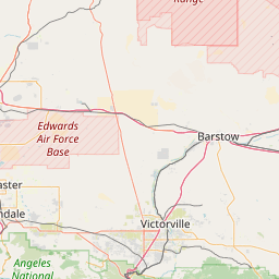
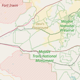
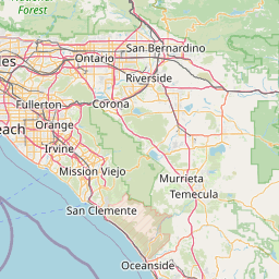
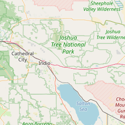
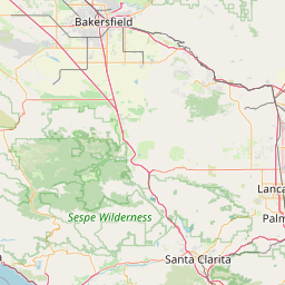
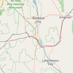
Coverage: High level repeater with coverage of the off-road trails of Calico and surrounding areas of Barstow, Harvard, Newberry Springs, Daggett, Yermo, Hinkley, Ft. Irwin and fifty miles out.
50 mi radius.
Sponsor: Silver Valley Repeater System
Website: http://www.facebook.com/groups/silvervalleyrepeatersystem
Notes: This repeater serves the Mojave Desert for recreation and emergencies purposes. All GMRS licensees and their family are welcome to use. Please follow GMRS identification requirements. This is a family repeater so please keep conversations appropriate. Note: All repeaters associated with the Silver Valley Repeater System are intended for personal use only. The primary purposes are emergency communication and recreational. Business use is strictly prohibited. For usage of commercial repeaters in the area, please contact Plantronics Communications at 760-256-1166. ยง 95.1705 (d) Individual licensee duties. The holder of an individual license: (1) Shall determine specifically which individuals, including family members, are allowed to operate (i.e., exercise operational control over) its GMRS station(s) (see paragraph (c) of this section); (2) May allow any person to use (i.e., benefit from the operation of) its GMRS repeater, or alternatively, may limit the use of its GMRS repeater to specific persons; (3) May disallow the use of its GMRS repeater by specific persons as may be necessary to carry out its responsibilities under this section.

Open Street Map


If you have an iPhone/iPod/iPad or Android device, please download the FREE official RepeaterBook app!

Copyright © 2006-2024 RepeaterBook.com. All Rights Reserved.
Created and owned by KD6KPC/WREQ745 since 2006.
All data, including non-copyrightable data, is protected from theft under Oregon law (ORS 164.377).